
Glendale in the 1870s
Before Glendale was Glendale, it was the Glendale Station (established in 1870) along the Missouri Pacific Railroad. And it was a collection of estates and scattered houses across the 1.2 square miles of Glendale’s current area.
A starting point for understanding Glendale during this period is the 1878 New Atlas for the City and County of St. Louis created by Julius Pitzman, St. Louis County’s land surveyor at the time. The atlas (shown to the right) shows the area around the railroad line stretching to Kirkwood on the west, Webster on the east until Manchester Market Road on the north. The atlas lists roads, property boundaries, ownership, parcel size and the approximate location of buildings and other features, listing in total 30 odd owners—a motley collection of farmers, country estate owners, and wannabe real estate developers. Comparing the owner’s names with other information taken from local newspapers of the time—the St. Louis Globe Democrat, the St. Louis Post Dispatch and the St. Louis Republic—as well as other sources of information provides snapshots of Glendale’s life at the time.

Industrialists and Country Farmers
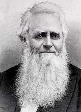
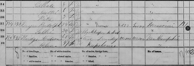
Among Glendale’s early inhabitants were business leaders for whom Glendale was their opportunity for a county home far away from the industrial bustle of the city. No one better typified this than Hudson E. Bridge (1810-1875), a owner of the Bridge and Beach Empire Stove Works, director of the Missouri Pacific Railway and charter director of Washington University. Hudson Bridge owned a significant area of land to the north and to the south of the railroad line and Glendale train stop (comprising the area of the contemporary Westborough Country Club and the portion of Oakland to the south). Born in New Hampshire, Bridge moved to St. Louis in 1838 to open his stove foundry which led to his fortune. For his time, Bridge was a wealthy man; his estate in Glendale in 1870 was estimated to be worth $200,000 ($5.1 million in today’s terms) and over the course of his life he gifted over $175,000 to Washington University.
Hudson Bridge, n.d.
Bridge and his family moved to the Glendale area in the 1860s; by 1870, he, his second wife Helen, and four children were living on the property, along with servants and associated farm labors. The location of his estate was undoubtedly part of his association with the Missouri Pacific Railroad, and Bridge used his position—both business wise and residence wise—to advance the railroad’s interests.
As a prominent local business man, he and his family were part of the area’s elite—with his estate the location of parties and events and his children part of the younger crowd followed by local papers. As a gentleman farmer, Bridge also participated in local agriculture competitions, with his Black Hamburg and Golden Hamburg grapes winning awards at a variety of settings.
After Bridge’s death in 1875, the estate passed to his wife Helen, who lived there with her sons until the family returned to New Hampshire in the 1890s.
Local Workingmen
Also living in Glendale during this period were craftsmen and farmers of less significant fortunes. Of these was the Venneman family—one of whom (Henry Venneman, 1831-1874) owned a 52-acre parcel on the west side of Collins (Sappington Road); the site runs along the current street that shares the family’s name. The Venneman’s were early residents of the Kirkwood area as well as worshippers at St. Peter’s Catholic Church in Kirkwood; Henry served as a manager of the church’s Cotillion in 1865.
Hudson Bridge and Helen Bridge in 1870 Census
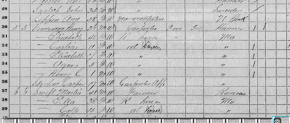
Henry Venneman and his family in the 1870 census
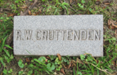
Burial Marker, Bellfontaine Cemetery
As a less prominent man than Hudson Bridge, there is less publicly known about Henry Venneman. Census records indicate he was born in Prussia in the 1830s; with no clear information on how he made it to St. Louis, he was undoubtedly one of many Germans moving to the Midwest during this time. The 1870 Census listed his occupation as a carpenter and noted he lived with his wife Elizabeth, four young children and carpenter’s assistant. His value of his estate was also significantly less that Bridge’s—at $3,000 (about $75,000 today). Other records from the period suggested Venneman was also involved in real estate and, along with a number of other people, lost property to a sheriff’s sale elsewhere in Kirkwood in 1873.
How Henry died is not known. Henry, his brother Bernard and other members of the family are buried at the old St. Peter’s Cemetery in Kirkwood. For a time, the Venneman family continued to reside in Glendale—census records from 1920 showed Henry’s son, Henry L. Venneman, living along Collins Avenue, and, ten years later in 1930, living off Taylor Avenue to the west in Kirkwood with his son.
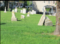
Venneman Family Graves, St. Peter’s Cemetery
Go West!
To the extent that Venneman dabbled in real estate, he was in good stead. While Glendale in the 1870’s was a home for some, the Pitzman map shows that many of the parcels in the area didn’t have a residence on them—that they were unimproved land. Additionally, the papers of the time show the active interest of many—residents and land owners alike—in the active promotion of real estate. In many ways, the interest in promoting Glendale as a residential community followed the designation of Glendale’s railroad stop some years prior. Access to the railroad made living in the Glendale area and pursuing commerce elsewhere—usually downtown—increasingly possible for upper-class families.
The prices of estates reflected that: A 5 acre estate (with orchards and a 6 room house) offered in 1878 for $2,500 ($64,000 in today’s terms) and a 10 acre estate (similarly with an orchard and a 6 room house) offered for $4,500 ($115,000 today). While those prices seem small in contemporary terms, remember that an average worker (non-farm) earned between $375 and $500 annually in 1870, and the cost of Glendale estates would have been 8 to 10 more than that average worker could afford.
Some of those involved people who were significant real actors in the city—like Roswell W. Cruttenden (1826-1891), who both owned an estate and kept up an active real estate business focused upon the city. Cruttenden was a bachelor, insurance and bank officer who owned a small estate (9 acres) off of Berry Road in the vicinity of where Essex Avenue is. From his office on North Main Street downtown, Cruttenden listed, bought and sold real estate across the booming city and emerging county, including in the Glendale area. He also participated in efforts—as a member of the Mercantile Association and other business groups—to advance the commercial interests of the St. Louis region, including advocating for better railroad construction in and out of the city. (Of interest to the historical society, Cruttenden was also an antiquarian involved in efforts to establish a St. Louis historical society.)
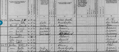
Cruttenden and his sister Ella in the 1880 Census
Cruttenden first emerged in St. Louis in 1847, where he was working as clerk downtown. By the 1860’s, he was firmly ensconced in the insurance industry (fire and casualty) and that allowed him access into real estate and banking, including as a director for the new Boatman’s Merchant Bank. Throughout the 1860s and 1870s, Cruttenden was purchasing real estate for amounts exceeding $10,000 ($367,000 in present value), and in 1869 he purchased his Glendale estate, where he would live for most of the remainder of his life. There he lived with sister Ella and continued his active business life, selling the property in 1890 right before his death in the fall of 1891. Cruttenden was certainly the man who made it good in the expanding St. Louis area. In 1890, his real estate investments were valued at $81,000 ($2.9 million today) and his will in 1981 valued his personal estate at $53,600 ($1.9 million today).